Héen Latinee
Héen Latinee Experimental Forest
The Héen Latinee Experimental Forest is the most recently designated of 83 experimental forests and ranges in the US Forest Service system.
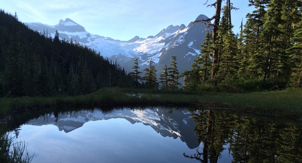
North of Juneau, 12,000 hectares of land is set aside as a natural laboratory for research, stewardship, and long-term studies. The Héen Latinee Experimental Forest (HLEF), established in 2009, one of 83 experimental forests and ranges in the US Forest Service system. It’s one of only two experimental forests in the perhumid Pacific coastal temperate rainforest, and is unique in encompassing two watersheds all the way from their glaciated headwaters to a tidal estuary. “Ridge to Reef” research is a theme of the experimental forest with integrated studies to understand the reciprocal interactions between marine and terrestrial systems.
Héen Latinee, meaning “River Watcher” in the Tlingit language, is set aside to act as a microcosm of a greater ecosystem. The forested valleys of the Cowee and Davies creek watersheds reach from over 1,770 meters of elevation down to sea level. Across this dramatic gradient, researchers can study ecological trends along elevation levels and the impacts of climate change on hydrology, forest structure, and ecosystem processes from sea level to the alpine. About 15% of HLEF is covered by glaciers, and the largest glacier is the Cowee Glacier which spans 9.6 square kilometers. The Cowee and Davies watersheds are characteristic of the thousands of moderately sized watersheds draining from the peaks of the Coast Mountains of Alaska and British Columbia. The valleys host brown and black bear, wolverine, moose, and deer, while the valley bottoms provide spawning and rearing habitat for several salmon species.
ACRC and US Forest Service researchers visit the experimental forest often, though access is difficult due to weather and terrain. Three weather stations from have been installed from 96 to 911 m elevation to quantify the change in precipitation and weather along an elevational transect. At 640 m a SNOTEL snow monitoring station was collocated with the weather station to provide detailed data on snow depth and water content. The data from these stations, as well as imagery from several webcams in the forest, is available in real time on the Forest Service website.
Contact
- Rick Edwards (rtedwards@fs.fed.us, 907-586-8801)
Collaborators
- Rick Edwards, USFS (rtedwards@fs.fed.us)
- Emily Whitney, UAS (ejwhitney@alaska.edu, Website)
- Dave D'Amore, USFS (ddamore@fs.fed.us, Website)
- Ryan Bellmore (jbellmore@fs.fed.us)